
Start a Long Branch Street Directory Search
A street-by-street inquiry works best as a chain, not as a single result. The county tax list supplies an annual assessment view, the map supplies parcel context, and a recorded instrument supplies a dated legal transaction. Each source has a narrower purpose than a general directory. Keep the address wording, unit, date searched, and record role together so a later result can be checked against the same parcel rather than a similar-looking street entry.
- Use USPS ZIP Code Lookup to normalize the street, city, state, and unit. Keep any alternate street format returned.
- Run the street in the OPRS Tax List Address search with Long Branch as the township and a deliberate tax year.
- Place the result in the Monmouth County GIS Property Viewer and compare the street label, block, lot, and immediately adjacent parcels.
- Check the Long Branch Tax Assessor information for the owner, mailing address, location, and physical-property details.
- Use OPRS land records to follow a deed or mortgage by block and lot, party name, document type, or date range. Record grantor and grantee roles separately.
- For a civic-record question, use the official voter registration check by name and date of birth, then treat any result as date-specific. Historic address clues belong in the library's directory materials.
Note: A property chain can identify record roles, but it cannot turn a tax or deed entry into proof of a current household.
Normalize a Long Branch Street Address
USPS accepts an optional company field, a required street address, an optional apartment, suite, or other unit field, required city and state fields, and an optional ZIP field. Enter the unit when it is known. A missing unit can join separate addresses in a multi-unit building and can make a tax or map result seem broader than the address in hand. Preserve the original form as well as the normalized result, especially when a historic source uses a section name.
USPS explicitly warns that a ZIP result does not establish that a person or company occupies the address. It is a mailing-address check. Compare it with the municipal township used by OPRS and with parcel geography before carrying the address into a deed, permit, or historical directory search.
Compare Long Branch Street Record Coverage
Address-keyed sources overlap, but none means the same thing. The table separates the record keeper, the time or role shown, and the proper use of the result. It also avoids silently turning a mailing address, transaction party, or historic directory listing into a statement about present residence.
| Long Branch Street Record | Custodian | Role or Date Shown | Best Use |
|---|---|---|---|
| USPS address result | USPS | Normalized mailing format | Check street, unit, city, and ZIP formatting |
| Annual tax list | Monmouth OPRS | Owner, location, assessment, selected year | Find a parcel from a street |
| Assessor information | Long Branch Tax Assessor | Owner, mailing address, location, building and lot details | Compare parcel facts and transfer-related changes |
| Parcel map | Monmouth County GIS | Spatial parcel and street context | Check block, lot, adjacency, and changed streets |
| Recorded instrument | Monmouth County Clerk, OPRS | Named transaction party and recording date | Trace a deed, mortgage, lien, or release |
| Permit or planning file | Long Branch department | Applicant or project record | Request the precise public file by address and date |
New Jersey voter materials have their own limits. The registration check uses first name, optional middle initial, last name, and date of birth. A certified voter list has statutory fields and exclusions, including no signatures except by court order. Neither is a universal Long Branch street directory, and name formats, inactive status, or privacy protections can affect what is available.
Search Long Branch Street Tax Records
OPRS Tax List Address mode is the practical first property search for a Long Branch street. It uses street name, township, and year, not ZIP. Try the street name without a directional or suffix when an exact form does not return a match, then compare the owner, location, assessment, block, lot, and qualifier. Select the year on purpose, because a result describes that annual tax-list context and post-certification changes may not appear.
| Address mode | Street name, township, and year |
|---|---|
| Owner mode | Owner name, township, year, and a tax-exempt option |
| Block and lot mode | Block, lot, qualifier, exempt-type options, township, and year |
| Aggregate mode | Regular, tax-list, special-tax, railroad, public-utility, or exempt-property summaries |
The OPRS consolidated search is a separate county entry point for property and other collections. Its presence does not replace the tax-list fields above, so note which OPRS route produced each result.
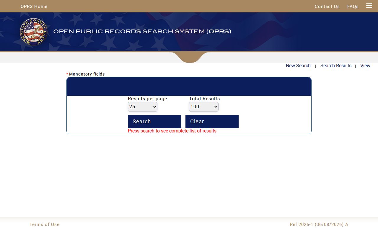
The consolidated screen is useful for seeing that OPRS separates collections and search modes rather than offering one all-purpose street field.
Follow Long Branch Street Deed Roles
OPRS land records can be searched by book and page, document type, block and lot, or party name. A name search requires a last or company name, may include a first name and document type, and uses a date range no wider than 90 days. The percent sign works as a wildcard. This short date window is a useful practical constraint: run separate windows rather than assuming a broad no-hit covers every recording.
Deed coverage begins January 1, 1970. Mortgage coverage begins January 1, 1976, while other published records begin October 1, 1996. A deed can show grantor and grantee names, addresses, consideration, street address, block and lot, and a legal description. A mortgage can add lender, borrower, loan amount, and property identification. These are transaction roles, not a continuous residence record.
The OPRS land-record help page explains the county's record categories and image limits. Digital images are reproductions and do not carry an official seal.
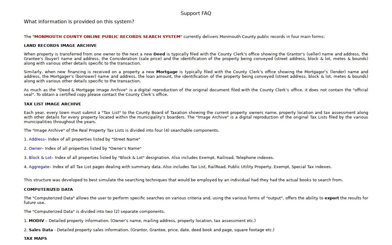
Use the help material to label an image, index result, or certified copy correctly before relying on it for a property history.
- Parcel
- A defined piece of land represented in tax and map records, commonly linked by block and lot.
- Situs address
- The physical property location, which can differ from the owner’s mailing address.
- Grantor and grantee
- The party transferring an interest and the party receiving it in a recorded deed.
- Qualifier
- An added tax-list identifier that distinguishes a particular property interest or unit.
- Criss-cross directory
- A directory arranged by address or street rather than only by name, useful for dated historical context.
Confirm Long Branch Street Parcels in GIS
The county GIS Property Viewer provides a spatial check after the tax-list search. Inspect the selected parcel, street labels, visible parcel identifiers, and immediately adjacent lots. This is particularly helpful for a corner address, a renamed street, or a parcel changed by subdivision. Record the map URL and a dated screen capture when the map display supports it, then verify the text facts in OPRS or with the assessor.
The research review could not establish an exact inventory of live GIS fields or layer names because the viewer is dynamic. That gap matters. Do not describe a map label as a field that has been independently verified, and do not draw an old boundary only from the current display. For a lot split, compare subdivision maps, deed legal descriptions, assessor lot size, and tax qualifiers.
Note: An adjacent parcel identifies nearby property, not an adjacent occupant or a complete modern block roster.
Route Long Branch Street Permit Records
For a building, inspection, construction, use, variance, zoning map, ordinance, subdivision, or site-plan question, first identify the city department that created the file. Agenda categories can help identify Planning Board and Zoning Board packets by date. Ask for the specific application, inspection, packet, or record type tied to the address rather than making a broad request for everything.
The Planning and Zoning page points to zoning permits, the Master Plan, Zoning Map, Zoning Ordinance, Transit Village map, and West End Design Overlay map.
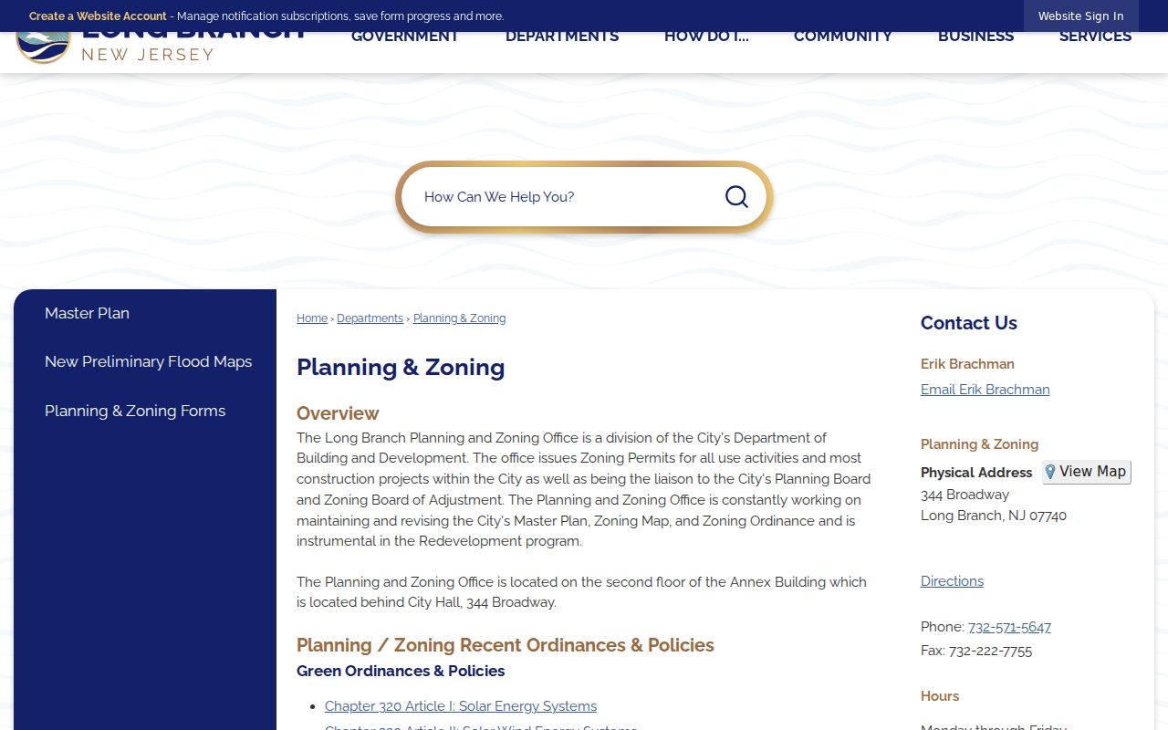
Planning records can explain a parcel's public land-use history, but an applicant name still needs its date and role recorded.
The Building and Development page supplies the city's permit and inspection route and refers to the Uniform Construction Code.
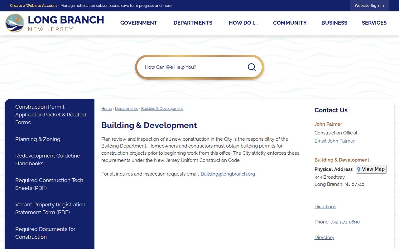
Use the building route when the question is an inspection or permit file, not a deed or tax record.
Trace Long Branch Street Name Changes
Older address work often needs a bridge between present wording and a historic street name or number. The New Jersey Historical Society finding aid for Long Branch documents includes municipal tax bills from 1916 to 1920 and ordinances from 1913 to 1934 concerning streets, curbs, street naming, and related matters. Compare a directory address, tax-list street, deed metes-and-bounds, current USPS form, and a map before deciding that a number change means a different parcel.
The Long Branch Library Local History service offers house-history help using directories, newspapers, maps, atlases, photographs, yearbooks, and local databases. Its historian can help separate a named resident from a deed holder, hotel guest, or business listing. The broader historical directory shelf is described on the Long Branch city directories page.
Sanborn volumes provide physical context, not a year-by-year address key. Documented 1890 coast sheets include Long Branch and North Long Branch, while a 1905 coast volume includes Long Branch and West Long Branch. The inspected sources did not establish a complete local Sanborn run.
Read 07740 on a Long Branch Street
Monmouth County assigns 07740 to Long Branch, Elberon, and West End. That shared mail label helps normalize an address and search historical material, but it does not establish a municipal boundary, neighborhood line, or current occupancy. Nearby control entries are West Long Branch 07764, Monmouth Beach 07750, Oceanport 07757, and Loch Arbour 07711. Keep the city or section wording used by the original source instead of replacing it with a modern assumption.
The tax-search mismatch is deliberate: OPRS uses street name, township, and year, while a ZIP follows mail delivery. A valid 07740 result may still need Long Branch chosen as the township. For the ZIP-specific workflow and its boundary limits, use the Long Branch ZIP directory after the address has been narrowed.
Long Branch Street Records Are Limited
A tax card, deed, voter result, directory entry, permit file, or map label can be useful evidence, but none alone proves a current residence. An owner may use another mailing address. A deed party may be an estate, trust, corporation, fiduciary, or representative. A voter record may be inactive or reflect a different name form. A city-directory entry is dated and may describe a historic household, hotel, or organization rather than the present use of the address.
New Jersey's Address Confidentiality Program and Daniel's Law can also explain a missing or redacted address. Respect redactions and protected information. Where a historical or block-level explanation answers the question, do not assemble a list of private people or add unit-level details that the research does not require.
Personal and lawful use. Long Branch street records should be used with care for history, civic questions, property context, or a specific verification. Do not use them to stalk, harass, intimidate, or publicize protected personal details.
Repair a Long Branch Street Record Gap
When OPRS stops at its date boundary, continue with County Clerk material, county deed books, archival microfilm, historical collections, tax lists, newspapers, probate, and maps. State archival holdings include microfilm copies of county deeds through 1900 while county originals remain with the county. A no-hit in the modern index is therefore a coverage question first, not a conclusion about the property.
The Monmouth County OPRA and records page also makes a useful routing distinction. County staff do not hold every record. Vital records belong with the municipality or the New Jersey Department of Health, and court records belong with the appropriate court custodian. For a missing permit, zoning packet, or street-improvement record, name the creating department, street, block and lot, record type, and date range in a narrow request.
Routing the request to the creator saves time and preserves the difference between county property files and municipal or court records.
Keep a Long Branch Street Evidence Log
A compact log makes conflicting forms visible. Start with the source-form address rather than overwriting it. Add the normalized mailing result, city or section label, tax township, block and lot, record date, and source. Then label each name by role. This approach is especially useful for seasonal coastal properties, multi-unit buildings, changed lots, and historic neighborhood names such as Elberon, West End, Hollywood, Norwood Park, Branchport, East Long Branch, North Long Branch, and Pleasure Bay.
| Address trail | Original form, USPS-normalized form, ZIP, city or section, and historic aliases |
|---|---|
| Parcel trail | Tax year, township, block, lot, qualifier, GIS reference, and assessor facts |
| Document trail | Instrument, date, grantor or grantee role, permit or planning file, directory year, and source |
| Assessment | Confidence note, unresolved conflict, privacy note, and next custodian to contact |
Clear role labels keep a Long Branch street directory useful without claiming more than the underlying record can support.